Staying hot, humid, and mainly dry until a summer cold front ramps up our rain and storm chances early next week
EAST TEXAS (KTRE) - We have seen a few spotty showers dot our east Texas landscape this afternoon. [KTRE]
Heat Wave Brings Unrelenting Conditions to East Texas
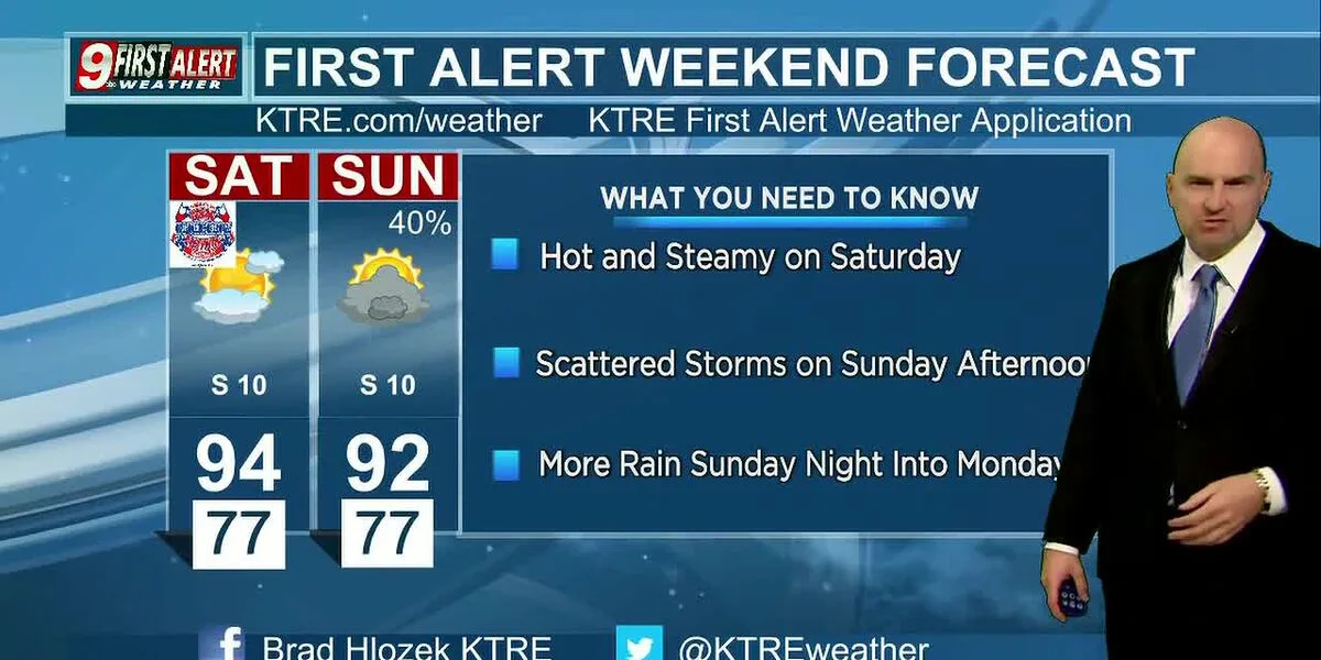
As the region bakes in the warmth of summer, east Texas residents are bracing for another sweltering day. The outflow boundary from a decaying area of rain and thunderstorms in upper east Texas has brought scattered showers to some areas, providing a brief respite from the heat. However, most parts of the region remain dry, with temperatures expected to soar into the low to mid-90s.
The intense heat wave is attributed to a high-pressure ridge that remains dominant over North Texas, keeping the area dry and hot. As a result, dew points are well into the 70s, leading to humidity levels that feel oppressive. With gusty south winds blowing at times, residents can expect breezy conditions, especially in the afternoon when clouds will gradually increase.
Residents are advised to exercise caution due to potential flash floods, particularly in low-lying areas and poor drainage spots. Isolated pockets of rain may cause quick ponding of water, leading to hydroplaning on roadways and brief road closures. As the weekend approaches, temperatures will only continue to rise, with feels-like temperatures climbing into the 102-105-degree range under partly cloudy skies.
Coverage from 4 newsrooms
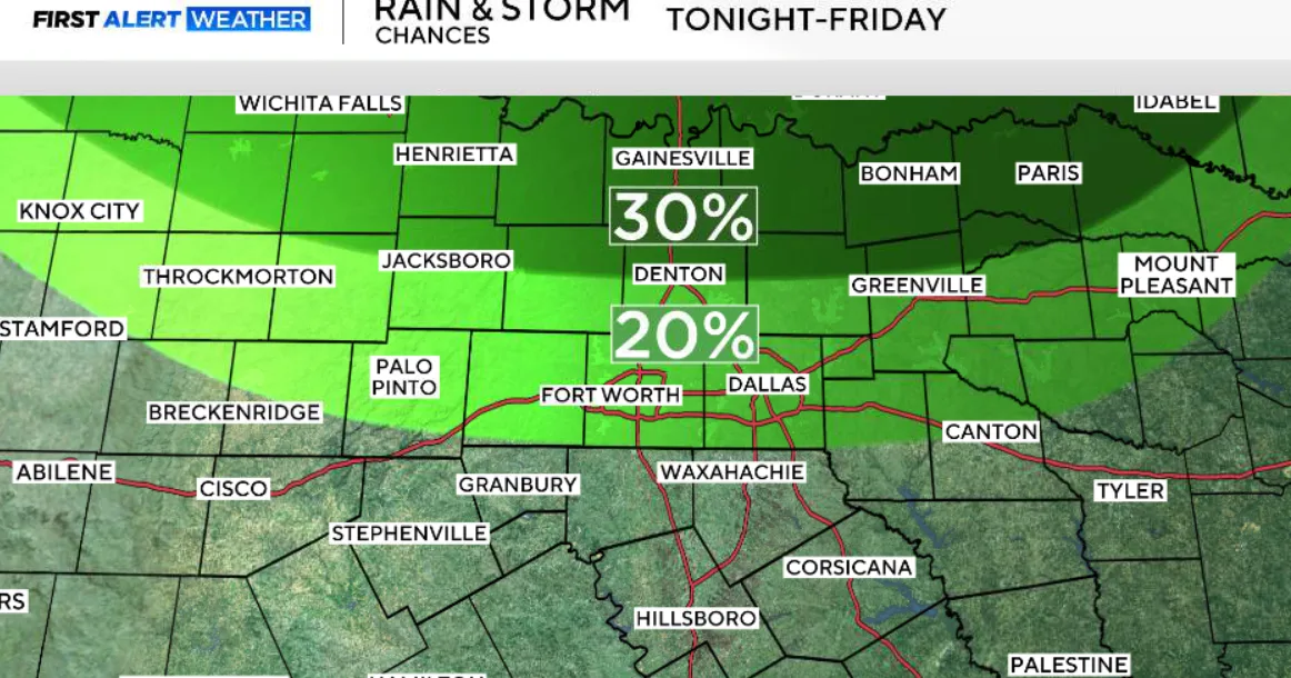
Scattered rain, storm chances return to North Texas amid high heat and humidity
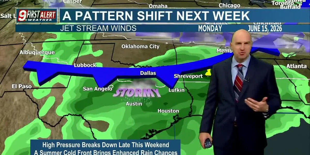
Staying hot, humid, and mainly dry until a summer cold front ramps up our rain and storm chances early next week
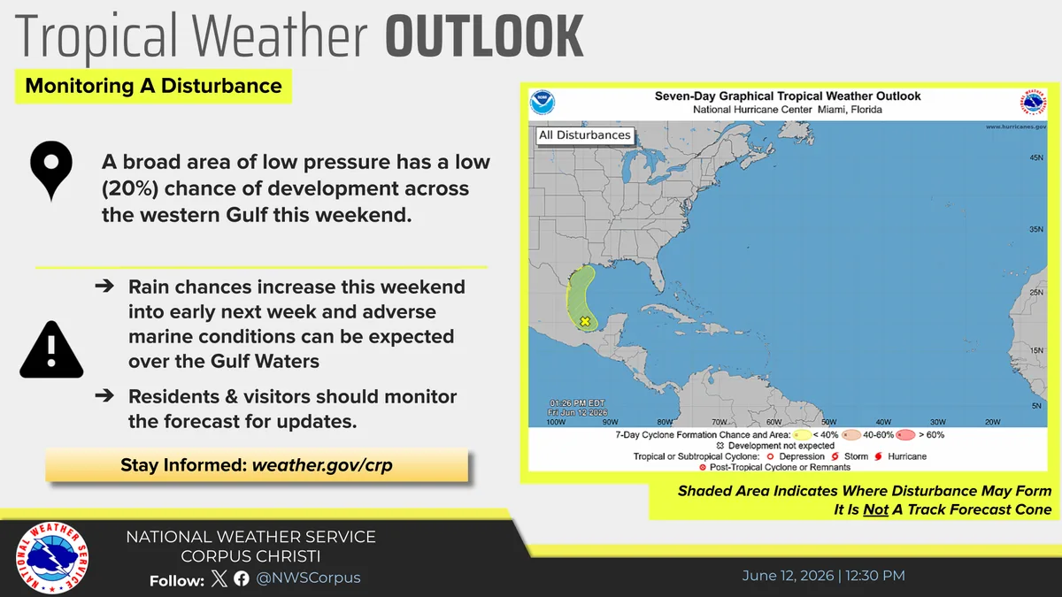
Rain expected in the Crossroads early next week, tropics monitoring a disturbance